SINCE 1991
AquaCoustic Remote Technologies specializes in inspections of underwater structures such as trunk or mainline sewers, hydro dams, reservoirs, ports and bridge abutments using a wide range of technologies to create accurate condition assessments. AquaCoustic principals have over 30 years experience in assessing underwater conditions. Our clients include many major civil engineering firms and municipalities throughout North America.
Surveys of port facilities using a rotating head profiling sonar provide accurate ships’ berth depth measurements
As commerce increases, port authorities and ship operators require accurate bathymetric information in order to maximize the use of port facilities and the vessels that use them. Knowing ships’ berths profiles and depths are critical in order to accommodate today’s vessels and new hull designs. Ramp and fairway depths must also be accurately known. In addition, ship’s thrusters, dredging operations, and the normal scouring and sedimentation action of tides and rivers can rapidly change underwater conditions.
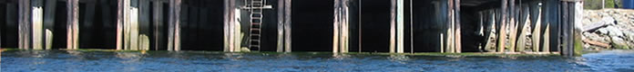
AquaCoustic uses specialized rotating head profiling sonar equipment to survey and obtain extremely accurate data with high resolution. Data can be gathered from the dock face, across the ship’s berth, under docks, vertical structures, and on each side of a boat track. This type of sonar also enables accurate surveys of areas up to vertical walls such as caissons, sheet piling, and under pile docks and overhangs which may be undermined.
The complete sonar system is compact and can be deployed from a structure, small boat or inflatable and is extremely cost effective. The data acquired by the sonar is recorded along with the XYZ position from a GPS positioning system, together with pitch, roll and heading data from a solid state bearing and inclinometer fixed to the sonar. The sonar is calibrated for local water conditions. An electronic tide gauge is used to collect and time-stamp tide conditions once a minute, and the boat operator follows a pre-determined on-screen overlapping survey track to enable verification of the collected data in post-processing.
All the survey data is recorded using our proprietary software which is used for post-processing and outputs a variety of data sets. Deliverables typically include XYZ data, AutoCAD drawings, full color 3D drawings, cross sections, and any other data specifically requested by the client.
Advantages
- Due to the rotating sonar head a boat can measure up to vertical walls such as caissons, sheet piling, and under pile docks and overhangs where boat soundings are unreliable or impossible.
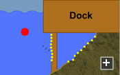
- Can be deployed from a dock or pier to obtain profile data out into the berth.
- Real-time on-screen review of sonar profiles allows modification of the survey as it progresses, unlike traditional surveying techniques which require post-survey data processing.
- Extremely accurate data collection and real-time field observations allow on-site assessment of unusual features that may require further investigation.
- Economical measurement techniques enable cost-effective regular inspections.
- Data can be used in AutoCAD or other modeling software.
Applications
- Accurately measure depth and create contours of ship’s berths and approaches.
- Accurately measure depth and create contours under floating structures such as ferry docks.
- Determine earthquake values for slopes from a single point.
- Pre-dredging surveys to determine volume measurements, and post-dredging surveys for quality control.
- Determine underwater conditions of pile docks and pipe and cable crossings, to ensure safety.
- Scour analysis.
- Siltation volume measurement.
- Debris identification.
- Repeat surveys to monitor conditions.
Sonar head with emanating sound pulse and return echoes, shown in slow motion See video ![]()
A robotic total station set up on a survey point on the deck of a dock. For centimetre (0.4 inch) accuracy we use a Trimble 5600 or Trimble S6 Robotic Total Station. The S6 has a spin rate of 115 degrees per second and a distance accuracy of +/- 0.8 mm
+1 ppm.
This diagram shows a fan-shaped sonar beam intersecting with a flat port bottom and targets. An image is built as the sonar head mechanically steps around its axis. A scanning sonar is used to build up a sound image of the bottom. In many cases the sonar image of a target will closely resemble an optical image, but a sonar image will always have less resolution than an optical image, due to the nature of the ultrasonic signals used to generate it.
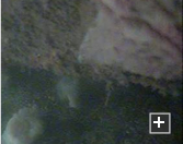
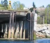
A video captured by a pole mounted camera shows undermining at the bottom of a caisson.